-40%
HUGE CACHE WW I II ATLASES, BATTLE MAPS 1918-45, 1849 AMERICAN ATLAS++ genuine
$ 79.2
- Description
- Size Guide
Description
At a yard sale where I bought 3 antique trunks, I also had to buy their contents, including these atlases and maps.I do not have the time or inclination to sell individually, so I will be selling them as a group at LOWER THAN BARGAIN PRICES!
Even if you don’t want all of these maps, here is a good opportunity to pick up some Christmas/birthday presents or trade goods
Because of past sales of printed matter, where the buyers photo printed and damaged the product then retuned it and wanted a full refund, I do not do returns on books/printed matter.
That being said, if there is a problem contact me, I feel with 5 minutes of emails, the problem can be resolved. (see my feedback)
Shipping will be insured USPS book rate.
Unless
noted, all maps are at least in good condition. A few have a tear in the margins, however the maps all good or better condition, if not indicated otherwise.
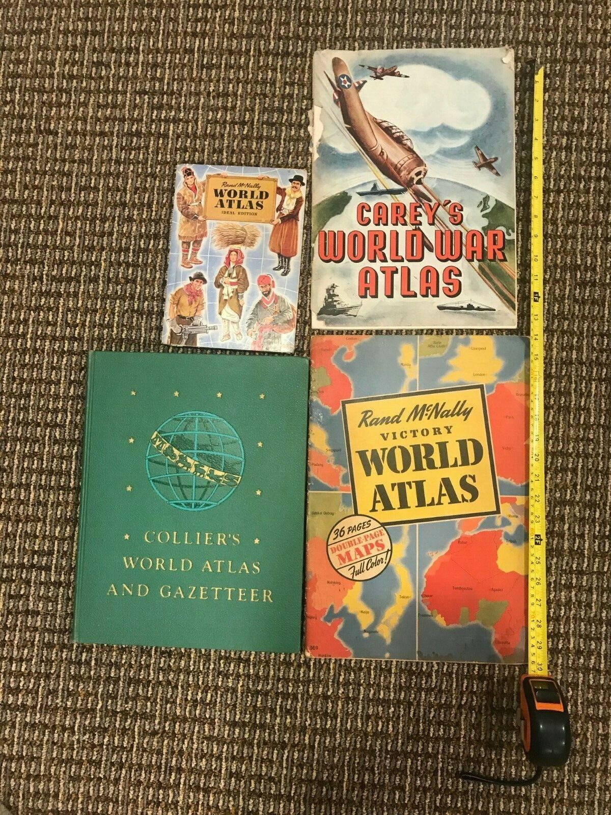
“Rand McNally Victory World Atlas, 36 PAGES DOUBLE PAGES MAPS, Full Color”, copyright 1943, 11” x 16”, paperback, good to good plus condition
“CAREY’S WORLD WAR ATLAS”, 24 pages, copyright 1942, 10” x 14 ½”, cover loose in fair condition, inside good to good plus condition, paperback
“COLLIER’S WORLD ATLAS AND GAZETTEER” 14 1/2” X 11”, hardback 336 pages, copyright, 1945, with two 1945, battle maps and pre-WW II maps, very good plus to excellent
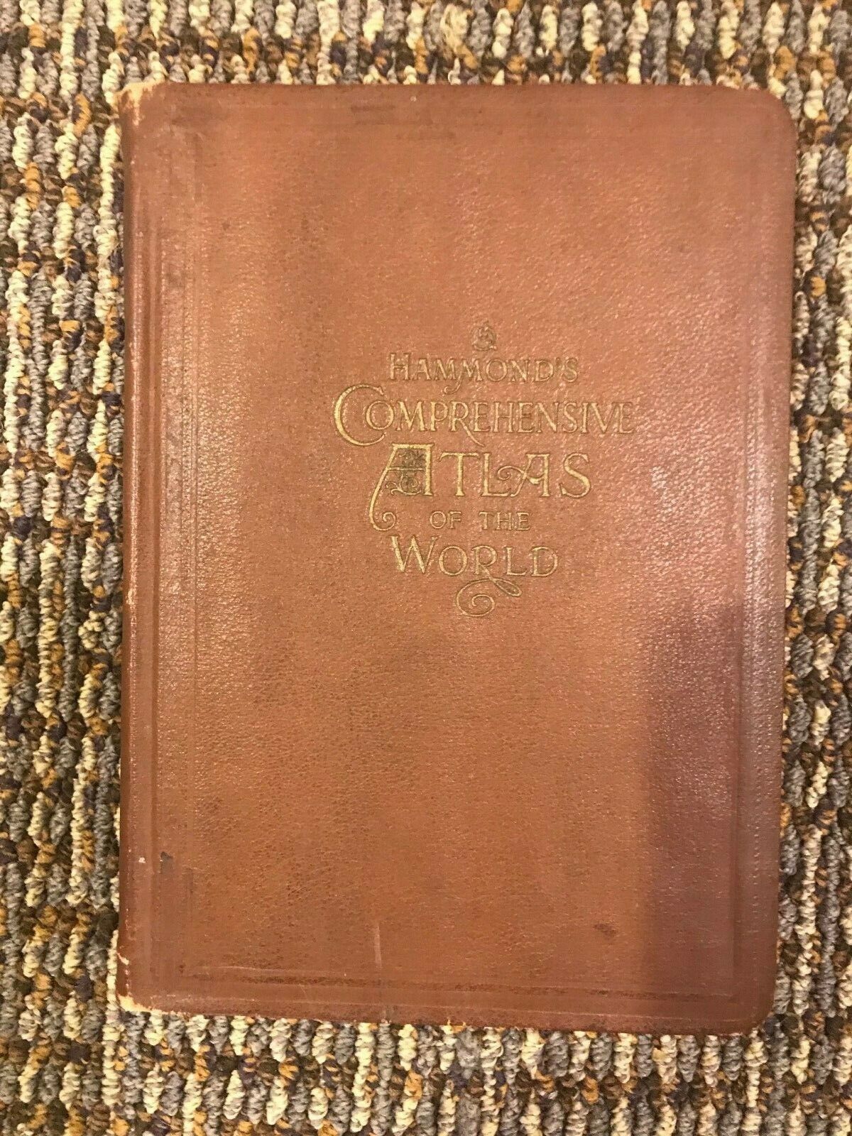
“HAMMOND’S COMPREHENSIVE ATLAS OF THE WORLD”, copyright 1918, 256 pages, leatherette covers, very good, very good plus condition
“Rand McNally WORLD ATLAS IDEAL EDITION”, copyright 1938, 96 pages, hardback, covers in good condition, maps very good plus/excellent, school type edition, 9 ½ “x 6 ¾ “
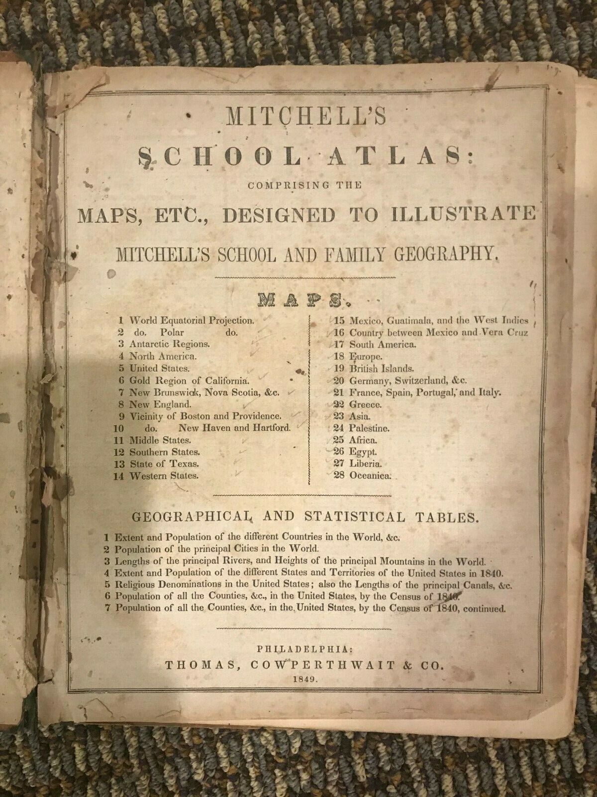
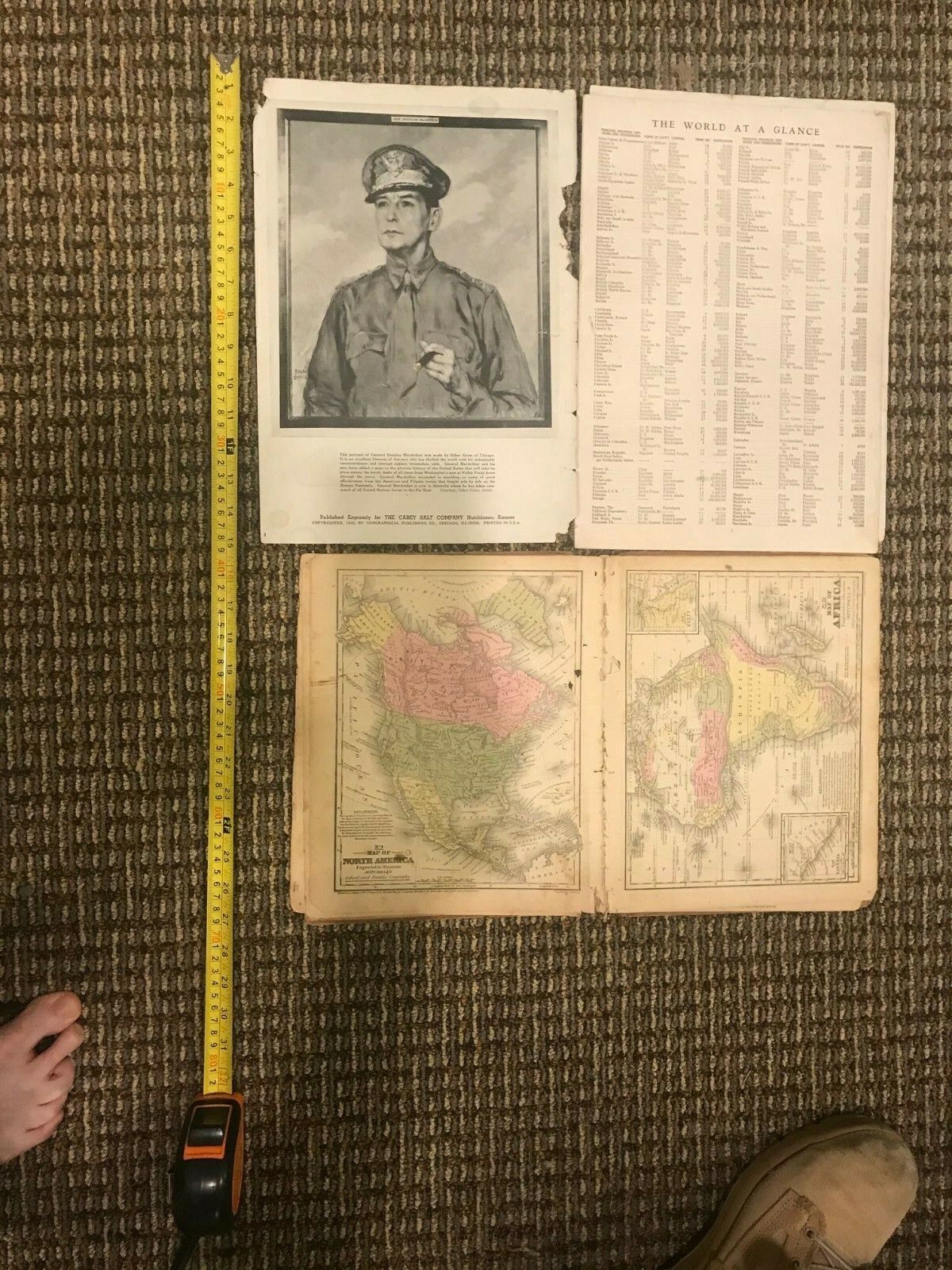
“MITCHELL’S SCHOOL ATLAS”, copyright 1849, hardback, covers in poor condition, some pages and maps missing, pencil/pen doodling on blank pages, maps in fair plus to good condition all in color include:
1.
Africa
2.
New England
3.
Middle States
4.
Chief part of the Southern States
5.
Western states and part of Virginia
6.
Mexico, Guatemala and the West Indies
7.
Western States
8.
South America
9.
Europe
10.
Great Britain and Ireland
11.
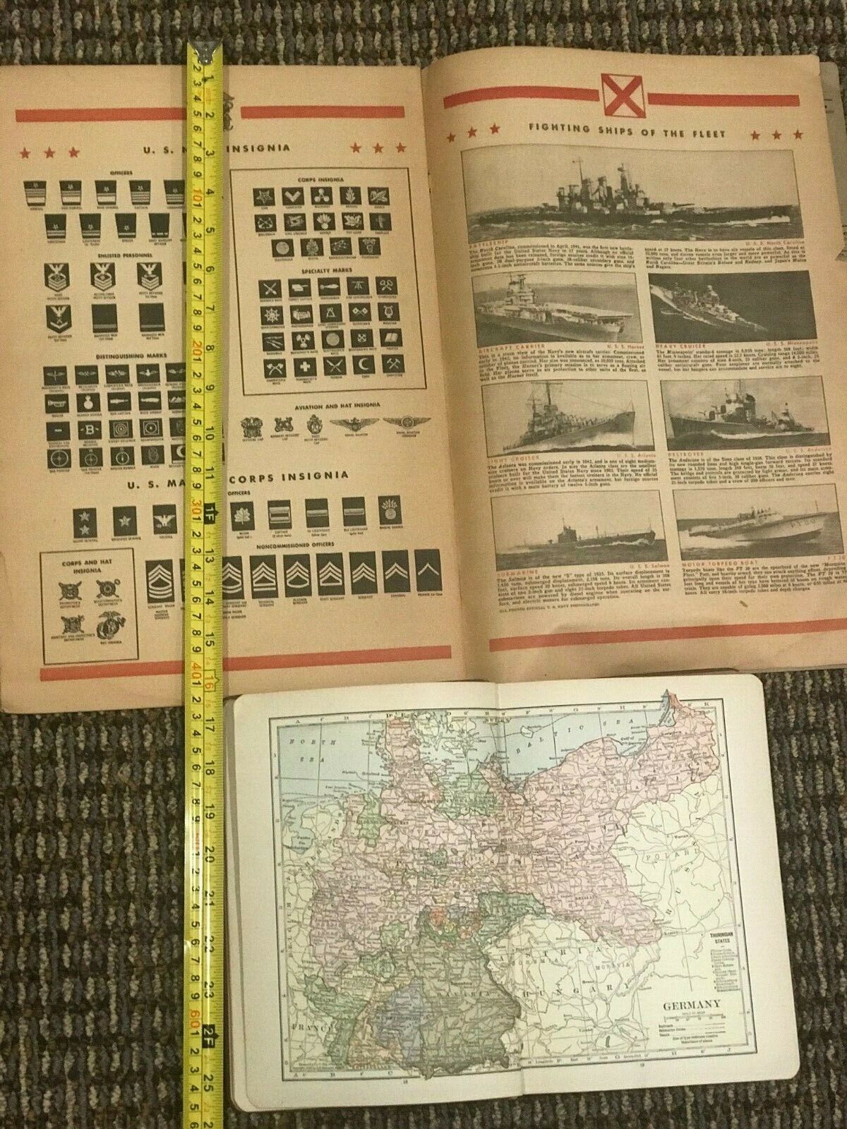
Germany, Switzerland and Northern Italy
12.
North America (fair)
13.
Oceanica
14.
Asia
15.
Numerous pages on population, canals, geographical data in fair condition
(Maps show numerous countries no longer in existence such as “Russian America”.)
National Geographic Atlas of the World, 4
th
edition 1975, 330 pages hardback 12”x18’, excellent (dust jacket poor shape) hardback
The Great Geographic Atlas, Rand McNally, 447 pages 15 x11, atlas and dust jacket excellent
1982, hardback
And individual maps:
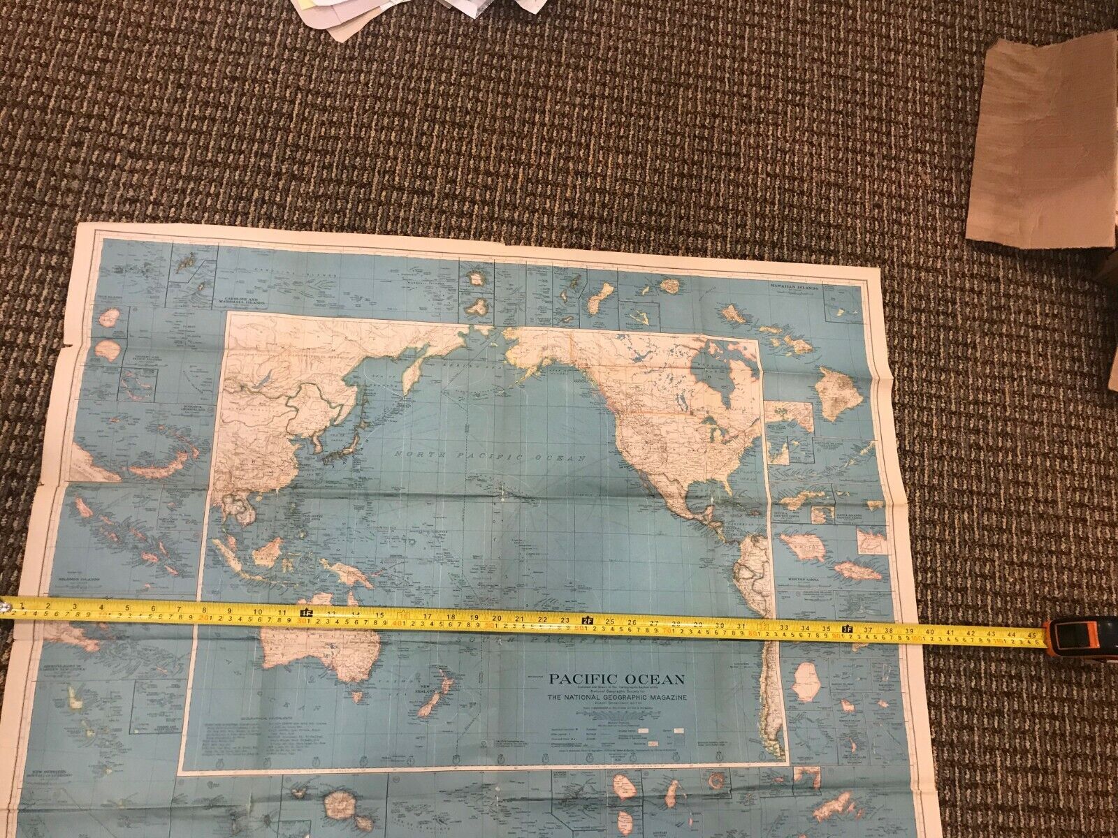
30” x 36” Pacific Ocean, copyright 1936 National Geographic Society, huge fantastic map showing old colonial possessions, the Japanese empire with their numerous island possession and about 15 insets of various island groups, about a dozen small splits have been repaired with archival tape from the back, good, good plus condition
…and a group of individual maps
, from various WW II dated atlases include:
Super rare/unusual
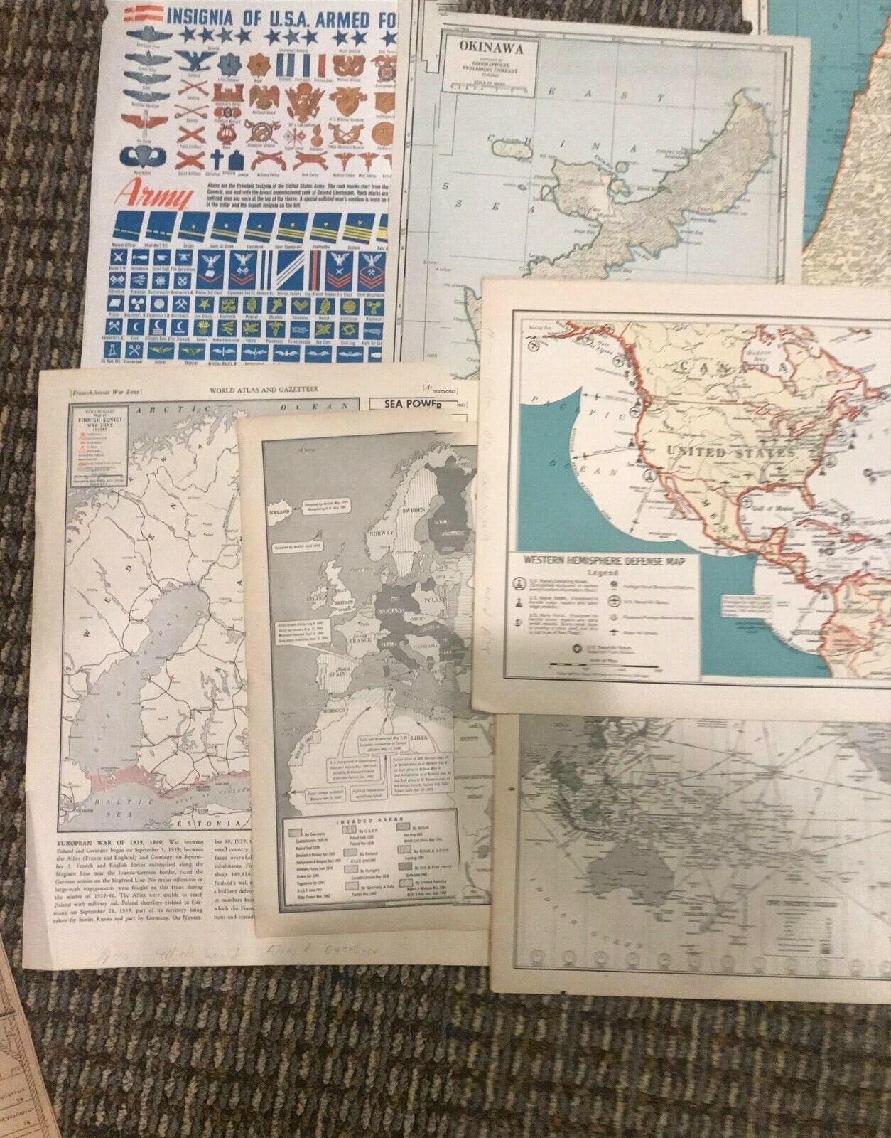
1940, “WESTERN EUROPE WAR ZONE”, WORLD ATLAS AND GAZETTER, 11” x 14”, pre battle of France map showing, major and secondary
fortifications, naval bases, air bases, Maginot, Siegfried and other lines; and on the on the reverse “Finnish-Soviet War Zone”, with map legend showing fortifications, Mannerheim Line, naval bases, air bases, mined areas, arctic highway, railroads, areas invaded by the Soviet Union , water normally icebound during part of winter; along the side showing warships for each of 7 countries , along with army strength and air power. (This map could easily be worth the 0 starting price of this auction.)
…and “WESTERN HEMISHERE DEFENCE MAP” 14” X 11”, Premier Edition Rand McNally World Atlas, 1942, WAR MAPS SUPPLEMENT, legend has U.S. Navy bases, operating bases, yards, naval air bases; foreign bases and proposed foreign bases, U. S Naval bases acquired from Britain; also from the same war maps supplement (same size) reverse Europe war map with also sorts of commentary;
battle map of China French Indochina Thailand and Chosen, reverse Africa war map with all sorts of commentary
GAZETTEER OF THE WORLD, 1943 12” X 9 ¼”, copyright C.S. Hammond & Co. legend has invaded areas from 1939-1943, with commentary
Hammond supplement Atlas, 1944 showing the pacific theater with air routes, in the legend, Naval Base & Stations, United State, British, Japanese, Dutch, U.S.S.R., 12” x 9”; reverse the MEDITERANEAN SEA” showing sea routes in1944
1945 “Map of the World Azimuthal Equidistant Projection United States Centered”, with “Airlines” “Proposed Airlines” (cool and unusual map) 14” x 11”; reverse THE FAR EAST, showing the Japanese empire on its last legs. Rand McNally & Co., Chicago/Collins World Atlas and Gazetteer, 1945
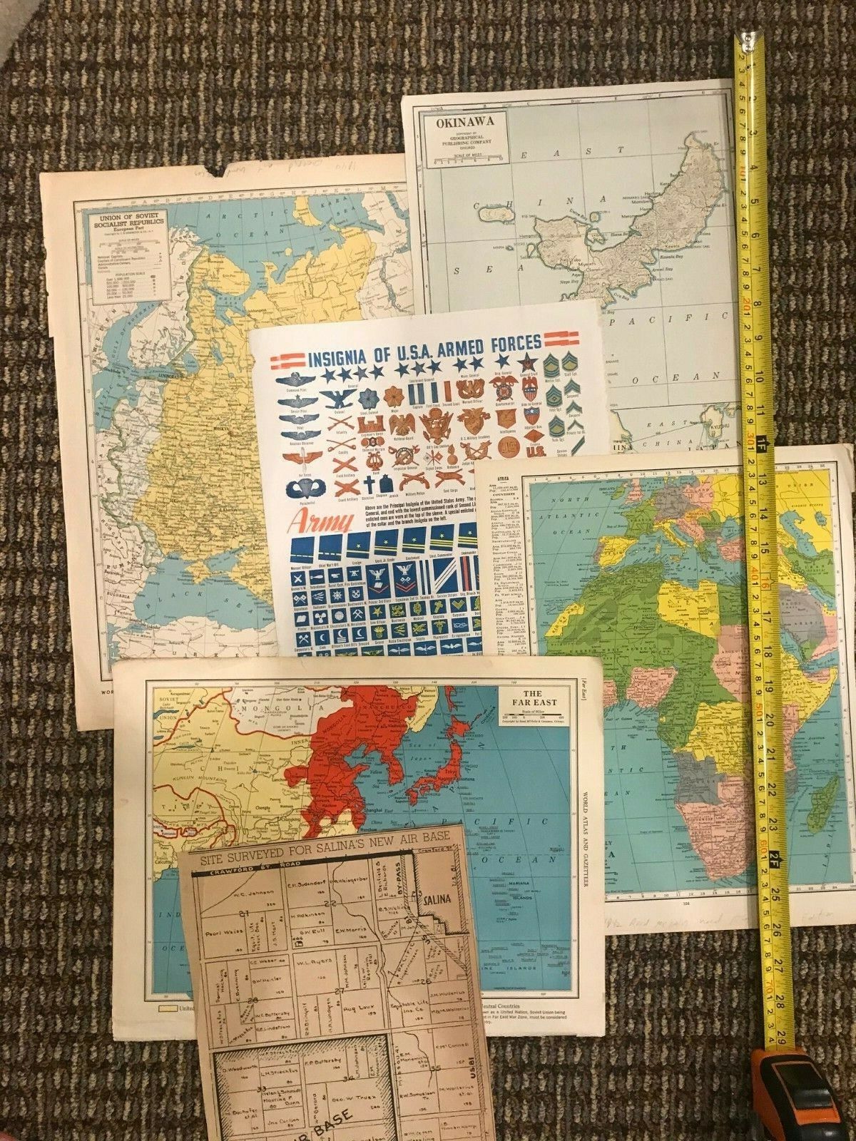
Super rare, “CZECHOSLOAVIA, THE BALTIC STATES, YUGOSLAVIA HUNGARY, 1944 Encyclopedia Britannica World Atlas copyright C. S. Hammond & Co., NY, 16” x 12”, 4 maps on 1 page. Shows Czechoslovakia, the parts Germany, (super politically incorrect) Poland and Hungary also stole. Reverse “UNION OF SOVIET SOCIALSIT REPUBLICS” again politically incorrect shows the parts of Finland, Poland, Baltic States and Rumania stolen by the Reds.
POLAND showing the land stolen from Czechoslovakia, also on the same page Denmark and Iceland 1944 Encyclopedia Britannica World Atlas copyright C. S. Hammond & Co., NY, 16” x 12”. The other half of the page shows Denmark with inserts of Iceland and the Faros Islands. Reverse Scandinavia.
PALESTINE, 1940 with insert of Jerusalem legend list include “Tower of David”, “Church of the Holy Sepulcher”, “Jews wailing place”, “British Consulate”, 11” x14” Rand McNally World Atlas Premier Edition, main map really cool with Gaza Strip called “PHILISTIA”. ½” and 1/16” blue ink mark hardly noticeable. Reverse is Iran, Afghanistan and Baluchistan.
TURKEY SYRIA AND IRAQ, a British Cyprus, a French Syria and many Italian controlled islands off the coast of Turkey.
Reverse colonial Africa.1942 Rand McNally World Atlas Premier Edition 14” x11”.
1945 CENTRAL EUROPE, shows German control of pockets on the French coast and Eastern Europe, otherwise the Germans are in bad shape. Reverse THE FAR EAST, shows the Japanese on their last legs, shows Japanese control of small Pacific islands. Colliers World Atlas and Gazetteer 14” x11” (appears to be very early 1945).
1943 14” x 11”, EUROPE AND THE MEDITERRANEAN, shows the Germans controlling the Ukraine, Crimea and a bit of the Caucasus. Kharkov is controlled by the Germans; Kursk and Orel controlled by the Russians. Spain controls Northern Morocco.
Reverse THE FAR EAST, shows the Japanese loosing New Guinea and names numerous
Pacific islands. Collins World Atlas and Gazetteer.
Okinawa New International Atlas of the World War History Edition early 1946 New International Atlas of the World War History Edition early 1946 with insert of Okinawa’s strategic importance; reverse Germany and Poland map and India Western Burma map
INSIGNIA OF U.S.A. ARMED FORCES 10” x 14”; reverse FLAGS OF NATIONS, New International Atlas of the World War History Edition early 1946
7 newspapers battle map clippings all appear to be from 1945 from the Kansas City Star (not all marked as such) 7” x 11” to 4 ½” x 2’, including 4” x 5” battle of Okinawa around Mother’s Day 1945 (based on the article on the reverse).
“SITE SURVEYED FOR SALINA’S NEW AIR BASE”, 8 x 11 Salina Evening Journal, Salina Kansas, undated, but was with same group of dated newspaper battle maps dated 1945
AFRICA, colonial map, with insert of former German colonies 1944 Hammond Self Reviewing Superior Atlas of the World 9” x12”; reverse CHINA and JAPAN
1943 Rand McNally Readers Edition Atlas of the World 10” x 6 ½”, WESTERN WAR ZONE, reverse AFRICAN METERRRANEAN & NEAR EAST WAR ZONE; SOUTH PACIFIC WAR ZONE, reverse NORTH PACIFIC WAR ZONE (damaged right corner on both maps); Middle East map
1944 Rand McNally Readers Edition Atlas of the World 10” x 6 ½”, WESTERN WAR ZONE, reverse AFRICAN METERRANEAN & NEAR EAST WAR ZONE; SOUTH PACIFIC WAR ZONE, reverse NORTH PACIFIC WAR ZONE; Middle East map
…and more recent induvial maps:
Vietnam, 18” x22” 1968, very good, Hammond
Archeology Dination Peru’s Archelogy Legacy (Prom Peru) very good 17” x 21”
Doctors Without Boundaries map 31” x 18” good (world map)
The Argus/Soviet Union, 30” x 22”, good, undated Argus Newspapers Limited not dated, but definitely vintage Cold War
National Geographic individual maps:
New Views of Our Sun, 2004, very good 23” x 20”
World Ocean floor Pacific Ocean, excellent 30” x 20” 1992
North American Indian Culture 30” x 19”, 2004 good plus
Earth At Night, good, 2004 34” x 21” good
Bird Migration Eastern Hemisphere, 2004 20” x 30” excellent
National Parks 1958, good 24” x 18”, very good
Archeological Map of Middle America, 1968, 24” x19”, very good
The Nile Valley, Land of the Pharaohs, 1965, 24” x 18”, good plus
The World Satellite, 2005, 31” x19”, good
Relation of Antarctica to the Surrounding Continents,1957, good plus 36” x 27”
A Cultural Map of the Middle East 21” x 35”, 1972 very good
